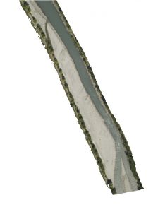
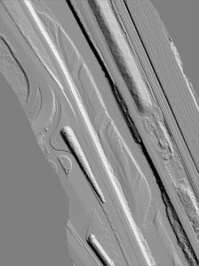
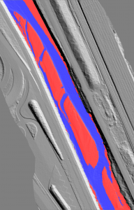
APRiM (Automatic Processing for River Morphology) is a software that aims at providing useful topographic characteristics for hydraulics![]() from LiDAR DTM and aerial images. The main goal is to achieve automatic identification of hydraulic and hydromorphologic elements such as water depth, width of the river bed, width of water channels, and the description of bars and islands.
from LiDAR DTM and aerial images. The main goal is to achieve automatic identification of hydraulic and hydromorphologic elements such as water depth, width of the river bed, width of water channels, and the description of bars and islands.
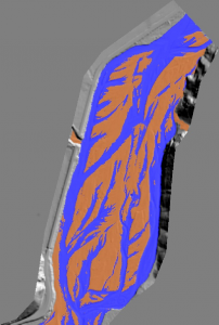
Combined segmentation from LiDAR DTM and orthoimage:
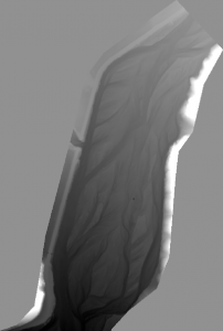
Segmentation of a braided river from LiDAR DTM only: